| Rogue River Valley, Oregon - Southern Oregon is divided into three main river basins; the Umpqua River, the Rogue River, and the Klamath Basin. The Umpqua meets the Pacific at Reedsport, the Rogue mouth is near Gold Beach, and the Klamath empties at the Redwoods National Park in Northern California. All three rivers have their headwaters in the Cascade Mountains on the slopes of Crater Lake, Oregon's only national park. The Rogue River is a designated National Scenic River, and formed much of the backdrop for the Meryl Streep movie "The River Wild." Jet boat trips and white water rafting are very popular. |
Rogue River Valley |
|
|
|
Search Travel Guides Oregon Maps Oregon History Pioneer Days Oregon Cavemen Touchdown Willie Ox and Log Wagon Dry Diggings July Surprise July Surprise II July Surprise III - END Gold Discovery Decline of Mining Mercury Mining More Oregon History |
Rogue River Valley - Oregon Travel Guide
Articles from the Historical Society in Josephine County Oregon July Surprise III - The Great 4th of July Surprise of 1909

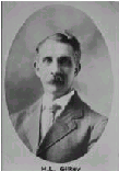
President Gilkey of the local Irrigation Company gave a fitting speech ending the irrigation demonstration. The water reached a point not far from the little white church that stood just to the north of the bridge. The water in the streets brought out the child in many a man that day. After all, it was Grants Pass in July, and a very hot afternoon. Grown men were rolling each other in the water on the side of Sixth Street. It was said they acted more like fish just off the hook and trying to flop their way back to the river. That eventful day was the moment in time when Josephine County took the first giant step towards getting water to the land, thanks to the waters of the Rogue stored behind the Ament Dam. As the Courier stated that day, many people went home encouraged by what they had witnessed. The Ament Dam fell into disrepair and receivership during its 19-year existence. The last remnants were finally removed just prior to the completion of the Savage Rapids Dam in November of 1921.
|
| Copyright 2002-2021 TUPINC |
| Rogue River Valley, Oregon - The Siskiyou Mountains stretch between the Cascade Mountains and the Coast Range at the California border. The entire area is more vertical than most other parts of the state, which leads to numerous waterfalls, lots of whitewater rapids, and some spectacular scenery. Rogue River Valley is outside the main population centers of the state and the area has a very rural flavor. Major industries are tourism, wood products and agriculture. The climate is generally milder and more Mediterranean than North Western Oregon. Average rainfallis about 20 % lower and the temperatures are a bit higher. |